A calculus problem by Chung Gene Keun
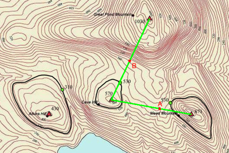 Sarah and Shane are hiking to the Great Pond Mountain in Maine. They have plotted their course (green line) in the above topographical map, which shows contour lines at intervals of 20 meters. They plan to hike from Mead Mountain, to Cove Hill and then to Great Pond Mountain, passing through Checkpoints A and B.
Which of the following routes would they experience the steepest ascent ?
Image credit: Wikipedia
This section requires Javascript.
You are seeing this because something didn't load right. We suggest you, (a) try
refreshing the page, (b) enabling javascript if it is disabled on your browser and,
finally, (c)
loading the
non-javascript version of this page
. We're sorry about the hassle.
0 solutions
No explanations have been posted yet. Check back later!