Three Long Trips
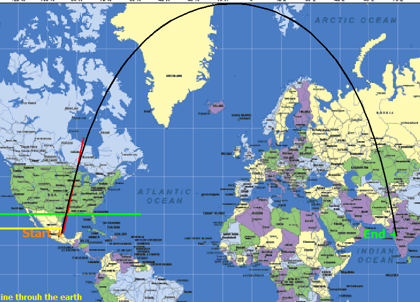
Route 1- From Mexico City Mexico to Bombay India.
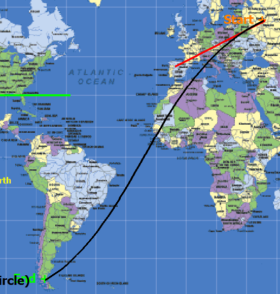
Route 2- From Moscow Russia to Punta Arenas Chile.
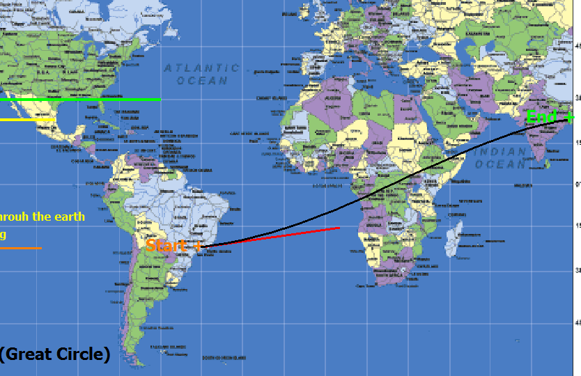
Route 3- From Sao Paulo Brazil to Calcutta India
 .
.
Each of the three maps shown has a black line that indicates one possible route between two distant cities. If aircrafts where to follow each of these three routes which of the trips would be the shortest distance required to complete the travel between the indicted cities? Each trip must follow the routes indicated closely.
This section requires Javascript.
You are seeing this because something didn't load right. We suggest you, (a) try
refreshing the page, (b) enabling javascript if it is disabled on your browser and,
finally, (c)
loading the
non-javascript version of this page
. We're sorry about the hassle.
All three maps indicate the shortest possible route between the cities indicated. Any apparent differences in the length of the trips is a result of the type of map used in this problem. A plane would travel any of the three route in one continues straight line along the earths surface when traveling between the cities indicated.
The distance calculated for the three trips along the routes shown are Mexico City Mexico to Bombay India. 15686 km.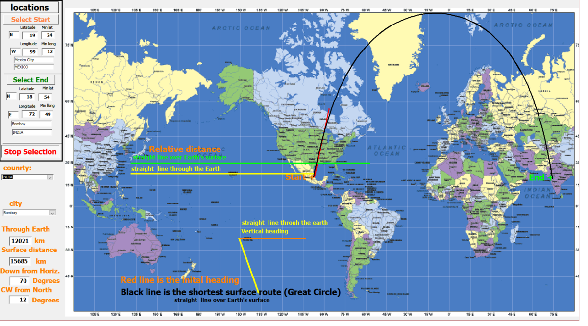
Moscow Russia to Punta Arenas Chile. 15615 km.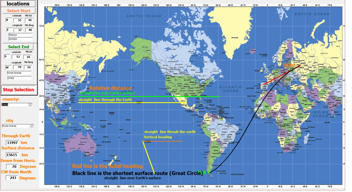
Sao Paulo Brazil to Calcutta India. 15442km.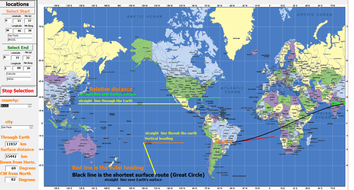
The three trips are within 1.5% of the same distance when calculating the distances as if the world was perfectly spherical. The world is not actually perfectly spherical and the calculated distances would be incorrect for this reason. I considered the three distances within a reasonable degree to be close to the same.
The problem is to illustrate the visual effect this type of map has on the perception of distance. Not to determine the accurate distance of these three somewhat obscure trips.
A globe and three pieces of wire can be used to demonstrate of the relative lengths, direction and show that the three routes over the earth’s surface would indeed be straight lines. The Mercator projection type of map used in this problem produces a distortion of the actual size and locations of features show on the map.